
Beyond Climate Change: Understanding the Real Forces Behind Assam and Nepal Floods
When I look at the recent Assam and Nepal floods, I find myself asking a question that goes beyond the headlines: Are we witnessing the consequences of climate change alone, or are several natural and environmental forces coming together at the same time?
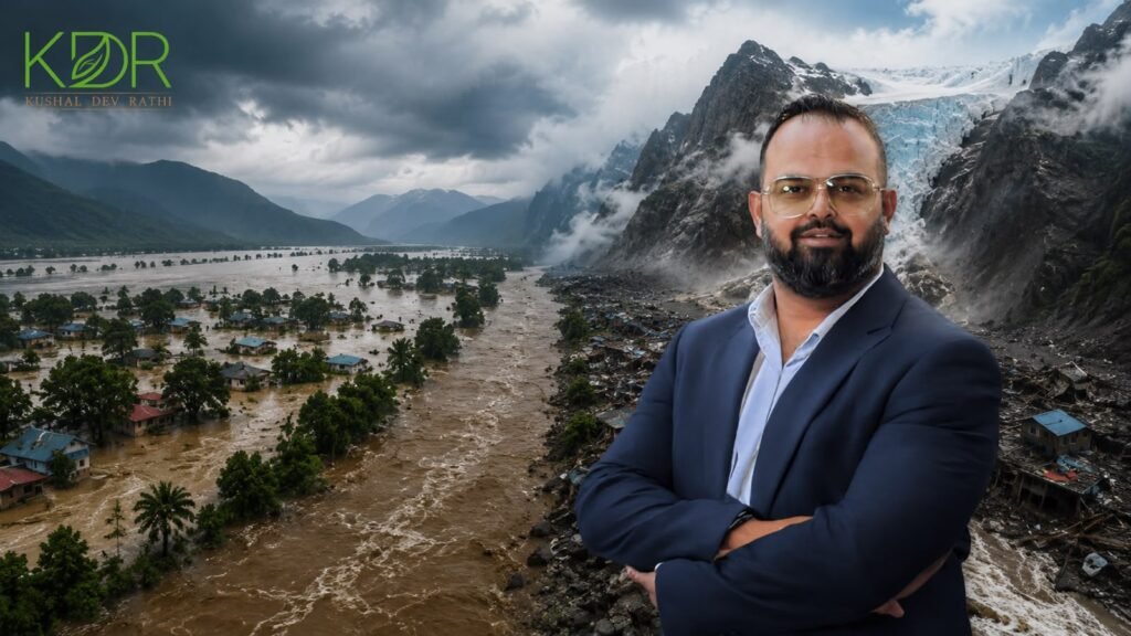
The Assam and Nepal floods have occurred within the same Himalayan environmental context, but they are not identical disasters. One has been driven largely by monsoon rainfall, runoff and the extraordinary behaviour of the Brahmaputra river system. The other emerged suddenly from a high-altitude mountain process involving glacier collapse, rock and ice movement and a powerful downstream surge.
That distinction matters.
As I studied the Assam and Nepal floods, I realised that simply calling every extreme event a “climate disaster” can sometimes hide the more interesting scientific story.
Nature is more complicated than that.
And perhaps that is exactly what we need to understand.
Why the Assam and Nepal Floods Made Me Pause
The Assam and Nepal floods made me pause because they reveal two very different ways in which a Himalayan landscape can suddenly become dangerous.
In Assam, repeated spells of heavy to extremely heavy rainfall during late June and early August 2026 produced waves of flooding across Upper Assam and surrounding catchments. The World Weather Attribution assessment found that the consequences were shaped not only by rainfall but also by the physical characteristics of the Brahmaputra basin, river morphology, exposure and structural vulnerability.
In Nepal, the Assam and Nepal floods story took a completely different turn. On 26 August, a sudden surge swept through the Lhende–Bhote Koshi system. Satellite evidence and subsequent scientific reporting indicated that part of a glacier collapsed, producing an ice-rock avalanche that temporarily blocked the river before the blockage failed and released a destructive flow downstream.
So, when I think about the Assam and Nepal floods, I don’t see one single disaster.
I see a conversation between mountains, water, climate, geology, and human settlements.
What Happened in Assam?
The Assam and Nepal floods cannot be understood without first understanding Assam’s geography.
The Government of Assam describes the state as having two major river valleys—the Brahmaputra and Barak—and estimates that around 39.58% of Assam’s geographical area is flood-prone. The government also records an average annual flood-affected area of roughly 9.31 lakh hectares.
That tells me something important.
Flooding is not an unusual visitor to Assam. It is part of the natural behaviour of a landscape shaped by enormous rivers, monsoon rainfall, mountain runoff and sediment.
During 2026, repeated rainfall episodes affected Upper Assam and surrounding hill catchments. The Assam and Nepal floods discussion therefore has to begin with the monsoon.
But it cannot end there.
The Brahmaputra Is More Than a River
When I study the Brahmaputra, I see a river that is constantly changing.
The Government of Assam describes the Brahmaputra basin as extending across Tibet, India, Bhutan and Bangladesh, with numerous tributaries feeding the main river. Its tributaries respond rapidly to rainfall, and when tributary floods coincide with a high Brahmaputra, the consequences can become severe.
This is one reason the Assam and Nepal floods should not be reduced to a rainfall statistic.
The Brahmaputra carries enormous quantities of sediment. Its channels migrate, banks erode, sandbars form and disappear, and the river continuously reshapes its floodplain.
The Assam Water Resources Department records more than 4.27 lakh hectares of land eroded by rivers since 1950 and an average annual erosion rate of around 8,000 hectares.
For me, this is a powerful environmental lesson.
A river is not simply water moving through a permanent channel.
A river is a living geographical process.
And the Assam and Nepal floods remind us what happens when we forget that.
Rainfall Is Only One Part of the Equation
The Assam and Nepal floods also demonstrate why rainfall alone cannot explain flood impacts.
The Brahmaputra’s tributaries drain steep Himalayan and hill catchments. Some northern tributaries have steep gradients, braided channels, and high sediment loads, while several are capable of producing rapid, or “flashy,” floods.
When rainfall falls across these catchments, water begins moving downhill.
If the ground is already saturated, runoff can become rapid.
If several tributaries rise simultaneously, river levels can increase quickly.
If sediment has altered the channel, the river’s capacity and behaviour can also change.
This is why I believe the Assam and Nepal floods need to be understood as hydrological events, not merely weather events.
Wetlands Are Part of the Flood Story
One of the most overlooked lessons from the Assam and Nepal floods is the importance of natural water-storage systems.
Wetlands can temporarily hold water, slow its movement and support natural drainage. Floodplains provide space for rivers to spread during high-flow conditions.
I often think of wetlands as nature’s own infrastructure.
They do not replace engineered infrastructure, but they can complement it.
When natural drainage pathways, wetlands and floodplain functions are maintained, landscapes have more ways to absorb and distribute excess water.
The broader lesson from the Assam and Nepal floods is therefore not simply that we need stronger structures.
We also need stronger ecological systems.
Forests, Soil and the Journey of Water
When I think about the Assam and Nepal floods, I try not to start at the point where water reaches a house.
I follow the water upstream.
Forests, vegetation and healthy soils influence infiltration, runoff and sediment movement. Land degradation can alter the speed at which rainfall becomes surface runoff and can increase the amount of sediment entering rivers.
But I would be careful here.
It would be scientifically inaccurate to say that deforestation alone caused the 2026 Assam floods.
The evidence points toward a combination of rainfall, river behaviour, geography, exposure, and environmental conditions.
That is an important distinction because the Assam and Nepal floods should teach us how systems interact, not encourage us to search for one convenient culprit.
What Does Climate Change Have to Do With It?
This is perhaps the most important question surrounding the Assam and Nepal floods.
The answer requires some scientific humility.
There is strong evidence that Asia is warming rapidly. The World Meteorological Organization’s State of the Climate in Asia reports that Asia is warming at roughly twice the global average and that glacier melt is accelerating.
The WMO also reports that 23 of 24 monitored glaciers in High-Mountain Asia showed mass loss during 2023/24.
These are significant findings.
But they do not automatically mean that climate change caused every individual flood.
That distinction becomes particularly important when examining the Assam event.
What Scientists Found About the Assam Rainfall
The Assam and Nepal floods have generated considerable discussion about climate attribution.
The 2026 World Weather Attribution study examined the rainfall associated with the Assam flooding and found that the rainfall was not exceptional in today’s climate, with estimated return periods of less than two years for the analysed three-day and 30-day rainfall events. It also found no clear observational trend and significant uncertainty because of limited rainfall observations across the region.
That does not mean climate change is irrelevant.
It means something more nuanced.
The broader climate system is changing, but the scientific evidence does not justify saying that human-induced climate change directly caused this particular Assam rainfall event.
When I consider the Assam and Nepal floods, this is one of the most important distinctions I want readers to understand.
Climate science is strongest when it tells us both what we know and what we do not yet know.
Nepal: When the Mountain Becomes Part of the Flood
The Nepal side of the Assam and Nepal floods story is dramatically different.
On 26 August 2026, a sudden flash flood swept through the Lhende Khola and Bhote Koshi system near the Nepal-Tibet border.
There was little warning because the disaster did not begin with a conventional period of heavy rainfall downstream.
According to reporting based on satellite imagery and scientific assessments, part of a glacier collapsed from high elevation. The falling ice and rock struck the river, temporarily blocking it. When that natural blockage failed, water, sediment, and debris surged downstream.
At least 19 bridges and around 40 kilometres of roads were reported damaged in the immediate disaster zone.
This is why the Assam and Nepal floods represent such an important scientific comparison.
In Assam, the river responded to intense rainfall.
In Nepal, the river appears to have responded to a sudden mountain failure.
Was the Nepal Event a GLOF?
The Assam and Nepal floods discussion also raises the term GLOF—Glacial Lake Outburst Flood.
A GLOF occurs when water stored in or around a glacial system is suddenly released, often because a natural dam fails.
However, I would be cautious about automatically describing the August 2026 Nepal event as a GLOF.
Current evidence points strongly toward a glacier collapse or ice-rock avalanche that temporarily blocked the Lhende River before releasing a destructive downstream surge. The exact mechanics are still being investigated.
That scientific uncertainty is important.
I would rather allow researchers to complete the investigation than force a dramatic label onto a developing event.
What Himalayan Glacier Change Tells Me
The Assam and Nepal floods have brought the Himalayan cryosphere into public attention again.
And here the evidence for long-term environmental change is much stronger.
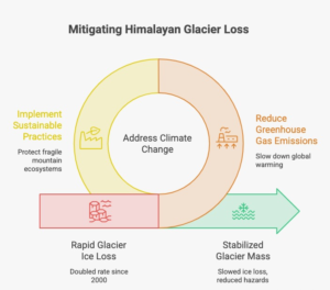
The International Centre for Integrated Mountain Development (ICIMOD) reported in March 2026 that glaciers across the Hindu Kush Himalaya are losing ice at roughly twice the rate observed around 2000. The assessment also reported cumulative ice-thickness losses of up to about 27 metres since 1975.
The Assam and Nepal floods therefore exist against a Himalayan background that is undeniably changing.
But glacier retreat does not mean that every flood is caused by glacier melt.
A changing glacier can influence:
- water availability
- glacial lake development
- slope stability
- meltwater timing
- downstream hazards
But an individual flood may still be triggered by rainfall, landslides, ice avalanches, lake breaches, or combinations of these processes.
The Connection Between Assam and Nepal
Are the Assam and Nepal floods directly connected?
Scientifically, I would answer: not as one physical flood event.
There is no evidence that the Nepal glacier collapse caused Assam’s flooding.
The two events occurred in different river systems and had different immediate triggers.
But the Assam and Nepal floods are connected in a broader environmental sense.
Both demonstrate the extraordinary complexity of the Himalayan water system.
Both involve mountain catchments.
Both ultimately involve rivers carrying water, sediment, and energy downstream.
Both remind us that changes high in the mountains can have consequences far below.
And both show why Himalayan environmental risk cannot be understood through political or administrative boundaries alone.
The Himalayas Are a Water System in Transition
When I look at the Himalayas today, I do not see only mountains and glaciers.
I see a vast water system.
The Assam and Nepal floods demonstrate different components of that system responding to different triggers.
The WMO has documented accelerating glacier mass loss and increasing hazards associated with glacier-related processes, including landslides and glacial lake outburst floods.
At the same time, the IPCC has established that mountain regions face interacting risks from warming, precipitation extremes, glacier loss, snow changes, landslides and other hazards.
The important word is interacting.
The future risk may not come from one factor becoming extreme.
It may come from several moderate changes occurring together.
Rivers Are Living Ecosystems
The Assam and Nepal floods have strengthened something I have believed for a long time: rivers should not be understood merely as obstacles that development needs to cross.
They are ecosystems.
They carry sediment.
They recharge floodplains.
They sustain wetlands.
They support agriculture and biodiversity.
They constantly reshape the land.
The Government of Assam itself uses satellite-based GIS analysis to monitor Brahmaputra migration, erosion, and deposition and to understand future morphological changes.
That is a useful direction.
The more accurately we understand a river’s behaviour, the better we can plan around it.
What the Assam and Nepal Floods Teach Me About Development
The Assam and Nepal floods have reinforced a principle I consider increasingly important:
Resilience must become part of development itself.
The question should not simply be:
“How do we protect ourselves after a flood?”
It should also be:
“How do we understand the landscape before we build?”
That means understanding watersheds, floodplains, drainage, wetlands, river migration and climate patterns.
The Assam Water Resources Department already identifies flood forecasting, warning systems, flood zoning, drainage improvement, riverbank protection, and other measures within its flood-management framework.
The Assam and Nepal floods remind me that engineered solutions and ecological understanding should work together.
What Can We Learn for India’s Environmental Future?
The Assam and Nepal floods are not only disaster stories.
They are planning lessons.
I believe India’s environmental future will require greater attention to five areas.
1. Better Early-Warning Systems
Warnings become valuable only when they reach people quickly enough to act.
Weather forecasting, river monitoring, satellite imagery and community-level communication all need to work together.
The WMO repeatedly emphasises early warnings and anticipatory action as important tools for reducing disaster impacts.
2. Better Understanding of Mountain Hazards
Glacier monitoring, glacial-lake mapping, slope observation and satellite-based surveillance can help identify changing risks.
ISRO’s Disaster Management Support Programme already uses remote sensing to monitor floods, landslides and other hazards and provide information to disaster-management agencies.
3. Protecting Natural Water Systems
Wetlands, forests, floodplains and natural drainage pathways should be considered part of environmental resilience.
4. Designing Infrastructure Around Risk
Roads, bridges and other infrastructure need to be designed with changing hydrological and geological conditions in mind.
5. Thinking Beyond Administrative Boundaries
Water crosses borders.
Mountain processes do not stop at district boundaries.
River systems connect communities across regions and countries.
The Assam and Nepal floods make a strong case for greater scientific cooperation, data sharing and basin-level thinking.
What Can We Learn as Citizens?
The Assam and Nepal floods also have a lesson for ordinary citizens.
Environmental responsibility is not only about planting trees or reducing waste.
It is also about understanding the landscape around us.
Where does rainwater go?
Where are the natural drainage channels?
Which areas are flood-prone?
What does the local river do during extreme rainfall?
How quickly can an official warning reach a community?
These questions may seem simple, but resilience often begins with awareness.
What Concerns Me Most
After studying the Assam and Nepal floods, what concerns me most is not that floods exist.
Floods have always existed.
What concerns me is whether our understanding is keeping pace with environmental change.
If glaciers are changing, we need better glacier monitoring.
If rainfall patterns are uncertain, we need stronger observation networks.
If rivers migrate, we need planning systems that recognise river morphology.
If wetlands store water, we need to value them.
If infrastructure faces new hazards, we need to design for those hazards.
That is how I interpret the Assam and Nepal floods—not as reasons for fear, but as reasons to become more intelligent about our relationship with nature.
My Reflection as an Environmentalist
The Assam and Nepal floods have reminded me of something fundamental.
Land is never only land.
A mountain is never only a mountain.
A river is never only a river.
Every landscape is part of a larger ecological system.
I believe responsible development begins when we understand those relationships.
For me, sustainability is not about stopping progress.
It is about making progress more conscious.
It is about recognising that long-term prosperity depends on healthy ecosystems, resilient communities, responsible land use and a willingness to listen to scientific evidence.
The Assam and Nepal floods have shown us what can happen when water, mountains, climate and geography interact with enormous energy.
Our responsibility is to understand those interactions better.
Hope and the Road Ahead
Despite the destruction associated with the Assam and Nepal floods, I do not believe the appropriate response is pessimism.
We have tools that previous generations did not have.
We have satellites.
We have increasingly sophisticated weather models.
We have glacier monitoring.
We have remote sensing.
We have river forecasting.
We have community-based warning systems.
We have decades of scientific knowledge.
And we have the ability to learn from every disaster.
The World Meteorological Organization has repeatedly emphasised early warning and anticipatory action. ICIMOD continues to expand scientific understanding of Himalayan glaciers and mountain risks. Governments are strengthening flood-management and disaster-preparedness systems.
The opportunity now is to connect these efforts.
The Assam and Nepal floods should not leave us with only memories of destruction.
They should leave us with better questions.
Learning the Language of Water
When I think about the Assam and Nepal floods, I return to the question I asked at the beginning.
Is climate change responsible?
My answer is more nuanced than a simple yes or no.
Climate change is changing the Himalayan environmental baseline. Glaciers are losing mass. Temperatures are rising. Mountain hazards are evolving.
But the Assam and Nepal floods also demonstrate that geography, rainfall, river morphology, sediment, glacier dynamics, land conditions and human exposure all matter.
The Assam event cannot scientifically be reduced to climate change.
The Nepal event cannot yet be assigned entirely to climate change either.
And that is not a weakness in the science.
It is the honesty of the science.
The greatest lesson I take from the Assam and Nepal floods is that nature does not operate in isolated boxes.
Water connects mountains to valleys.
Rivers connect upstream landscapes to downstream communities.
Glaciers connect climate to hydrology.
Wetlands connect ecology to resilience.
And our decisions connect today’s environment to tomorrow’s future.
I believe the wisest response to a changing environment is not fear.
It is understanding.
The Assam and Nepal floods are telling us something important: we cannot build a resilient future by trying to defeat nature.
We have to learn its language.
And perhaps the future of responsible development begins there.
FAQs
1. Why are the Assam and Nepal floods happening?
The Assam and Nepal floods result from different immediate triggers operating within the broader Himalayan water system. In Assam, flooding has been linked to intense monsoon rainfall, rapid runoff from surrounding catchments, rising tributaries, and the dynamic behaviour of the Brahmaputra river system. In Nepal, the recent flash-flood event involved a sudden high-altitude mountain process, with evidence pointing toward glacier collapse, ice-rock movement, temporary river blockage and subsequent release.
The wider climate context is also important. The World Meteorological Organization (WMO) reports significant warming and accelerating glacier loss across Asia, but this does not mean every individual flood can automatically be attributed to climate change. The Assam and Nepal floods demonstrate why each event needs to be examined according to its actual physical mechanism.
2. Are the Assam and Nepal floods directly connected?
The Assam and Nepal floods are connected geographically and environmentally through the larger Himalayan mountain-water system, but they should not be treated as one physical disaster.
Assam’s flooding is closely associated with the Brahmaputra and its tributaries, monsoon rainfall and the enormous Himalayan catchment feeding the river system. Nepal’s recent event occurred within the Bhote Koshi–Lhende river system and was linked to a sudden mountain process.
There is currently no evidence that the Nepal event directly caused the Assam flooding. However, both events demonstrate how Himalayan mountains, glaciers, rainfall, rivers and downstream communities are interconnected. The International Centre for Integrated Mountain Development (ICIMOD) provides extensive research on these interconnected Himalayan systems.
3. Is climate change responsible for the Assam floods?
The relationship between climate change and the Assam and Nepal floods requires careful scientific interpretation. Climate change is warming the Himalayan and wider Asian region and is contributing to significant changes in glaciers, snow and hydrological conditions. However, that does not establish that climate change directly caused every individual flood.
The 2026 World Weather Attribution analysis of the Assam flooding found substantial uncertainty around rainfall trends and did not identify a clear detectable climate-change signal in the specific rainfall event examined. The assessment also highlighted the importance of exposure and structural vulnerability in determining flood impacts.
For the broader climate context, the IPCC provides the scientific assessment of how warming influences precipitation, glaciers, extreme weather and mountain environments.
4. What caused the recent Nepal flood?
The Nepal component of the Assam and Nepal floods story appears to have been triggered by a sudden high-altitude mountain process rather than simply conventional rainfall flooding.
Available satellite observations and scientific reporting indicate that a glacier-related ice and rock collapse entered the Lhende River, creating a temporary natural blockage. When that blockage failed, water, debris and sediment moved rapidly downstream into the Bhote Koshi system.
The precise sequence and mechanics remain an area of scientific investigation. This is why I believe it is important not to simplify every glacier-related flood as a GLOF. The Department of Hydrology and Meteorology, Nepal, is an important official source for Nepal’s hydrological and meteorological monitoring.
5. How does the Brahmaputra contribute to the Assam floods?
The Brahmaputra is central to understanding the Assam and Nepal floods, particularly the Assam side of the story. It drains an enormous transboundary catchment and receives water from numerous Himalayan and hill tributaries.
During periods of intense monsoon rainfall, these tributaries can rise rapidly and deliver large volumes of water and sediment into the main river. The Brahmaputra is also highly dynamic, with channel migration, erosion, deposition and shifting sandbars influencing how floodwaters move across the landscape.
The Assam Water Resources Department documents the state’s river systems, flood behaviour and erosion patterns. Understanding the Brahmaputra as a living river system is therefore essential to understanding Assam’s recurring flood dynamics.
6. Are Himalayan glaciers making floods more dangerous?
The Assam and Nepal floods have drawn renewed attention to Himalayan glaciers because the region’s cryosphere is changing significantly.
According to ICIMOD’s Hindu Kush Himalaya assessment, glaciers across the Hindu Kush Himalaya are losing ice at an accelerating rate, with the rate of loss approximately doubling compared with the beginning of the 21st century. The WMO has similarly reported widespread glacier mass loss across High-Mountain Asia.
Changing glaciers can influence glacial lakes, meltwater, slope stability and mountain hazards. However, glacier change should be treated as one component of flood risk rather than the automatic explanation for every event.
7. What is a Glacial Lake Outburst Flood, or GLOF?
A Glacial Lake Outburst Flood, commonly called a GLOF, occurs when water stored in or around a glacial lake is suddenly released. The resulting surge can travel rapidly downstream, carrying sediment, rocks, and debris.
In the context of the Assam and Nepal floods, understanding GLOFs is particularly important because Himalayan warming can contribute to changes in glaciers and the development or evolution of glacial lakes.
However, not every glacier-related flood is a GLOF. A glacier collapse, ice-rock avalanche, landslide dam failure and glacial-lake outburst are different physical mechanisms. Research from ICIMOD and peer-reviewed Himalayan hazard studies can help distinguish between them.
8. Are the Assam and Nepal floods caused only by natural factors?
The Assam and Nepal floods demonstrate that flood disasters generally emerge from interactions between natural hazards and environmental or human conditions.
Natural processes can include monsoon rainfall, steep mountain terrain, river discharge, sediment movement, glacier instability, landslides and flash floods. At the same time, factors such as floodplain exposure, infrastructure location, drainage conditions and the availability of natural water-storage systems can influence the consequences of those hazards.
This does not mean that any particular community, project or government should be blamed. Instead, it highlights the importance of understanding exposure and resilience. The World Bank provides extensive research on integrated disaster-risk management and climate resilience.
9. What can India learn from the Assam and Nepal floods?
One of the strongest lessons from the Assam and Nepal floods is that resilience needs to begin before a disaster occurs.
I believe several areas deserve continued attention: better rainfall and river monitoring, stronger early-warning systems, glacier and glacial-lake observation, floodplain mapping, watershed management, wetland conservation and climate-informed infrastructure planning.
India already uses satellite technology extensively for disaster monitoring. The Indian Space Research Organisation (ISRO) and its disaster-management programmes use Earth-observation data for applications including flood and landslide monitoring.
The National Disaster Management Authority (NDMA) also provides national frameworks and guidance for disaster preparedness and risk reduction.
10. What is the biggest environmental lesson from the Assam and Nepal floods?
For me, the deepest lesson from the Assam and Nepal floods is that nature does not operate in isolated compartments.
A glacier can influence a river. A mountain slope can suddenly change a river’s behaviour. A river can reshape a floodplain. A wetland can temporarily store water. A forest can influence runoff and soil stability. Climate change can alter the background conditions under which all these systems operate.
That is why I believe the answer is not to search for a single culprit.
The better response is to understand the entire system.
The Assam and Nepal floods remind us that environmental responsibility is ultimately about learning how mountains, water, climate, ecosystems and human settlements interact—and using that knowledge to build a more resilient future. The World Meteorological Organization and UN Office for Disaster Risk Reduction both emphasise stronger early warning, preparedness, and risk reduction as essential elements of future resilience.
